Using web services
This user guide contains instructions on how to consume a range of services through both web based and desktop GIS applications.
Web services are a live data stream and therefore require a fast and reliable internet connection. NZP&M publishes data as a web service using the Open Geospatial Consortium (OGC) Web Map Service (WMS) and Web Feature Service (WFS) standards, as well as Environmental Systems Research Institute (ESRI) feature services.
OGC WMS/WFS are an open-source standard of web service that can be used in a range of Geographic Information Services (GIS) applications. ESRI feature services are specific to the ArcGIS suite of applications.
The method for accessing the data layers within a service differs slightly depending on the application you are using and the type of service you are trying to consume. Guidance on using services in common GIS applications is provided further down this page.
NZP&M’s web services are available on our ArcGIS Portal:
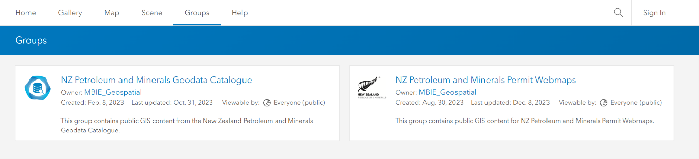
ArcGIS Portal Groups — data.nzpam.govt.nz
Accessing ArcGIS Portal
Here you will find 2 publicly accessible groups containing a range of permit and technical data for petroleum and minerals (see screenshot below). Click on the groups to expand them and see the content within.
Accessing OGC services and ESRI feature layers
To access OGC, WMS and WFS services, as well as ESRI feature layers and map image layers, open the corresponding portal item for the WMS, WFS, or feature layer and scroll down to the ‘URL’ section of the webpage. Copy this URL into the application that you would like to consume the WMS, WFS, or feature layer in.

More information
ArcGIS Pro
To add services to ArcGIS Pro, follow the ESRI user guidance here:
Open Geospatial Consortium (OGC) services | ArcGIS Pro — ESRI.com
Portal for ArcGIS
To access services in Portal for ArcGIS, follow the ESRI user guidance here:
OGC portal | ArcGIS enterprise — ESRI.com
ArcGIS Online
To access services in ArcGIS Online (AGOL), follow the ESRI user guidance here:
OGC online help | AGOL — ESRI.com
MapInfo
To access services in MapInfo, follow section 5 of the Precisely user guide here:
MapInfo Pro user guide [PDF 20,600 KB] — Precisely.com
Quantum Geographic Information System (QGIS)
To access services in QGIS, follow section 23 of the QGIS user guide here:
Section 23: Working with OGC — QGIS