
Land excluded from our minerals and petroleum programmes
Areas excluded from New Zealand’s Minerals and Petroleum Programmes due to their importance to iwi or hapū. These include sacred sites, protected reserves, and lands included in Treaty settlements, ensuring they are safeguarded from exploration and extraction activities.
On this page:
Land excluded from the Minerals Programme for Petroleum
The land listed below is excluded from the operation of the Minerals Programme for Petroleum 2025. The excluded land is marked in blue colour.
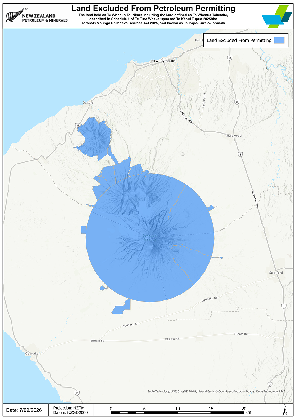
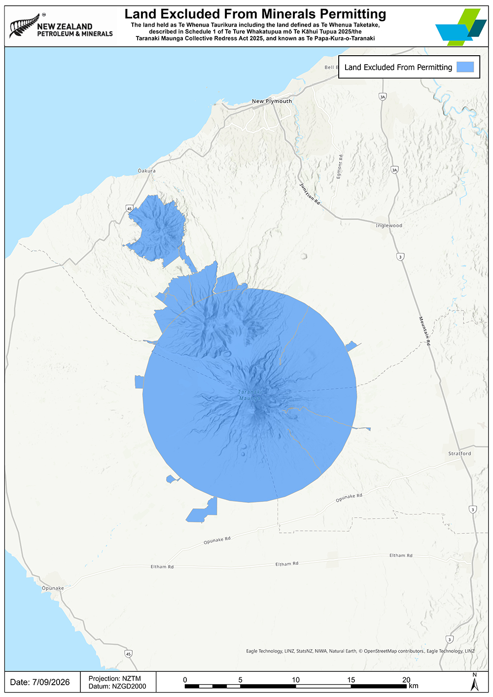
1. Te Papa-Kura-o-Taranaki
Includes Te Whenua Taurikura and Te Whenua Taketake, as defined in Schedule 1 of the Taranaki Maunga Collective Redress Act 2025.
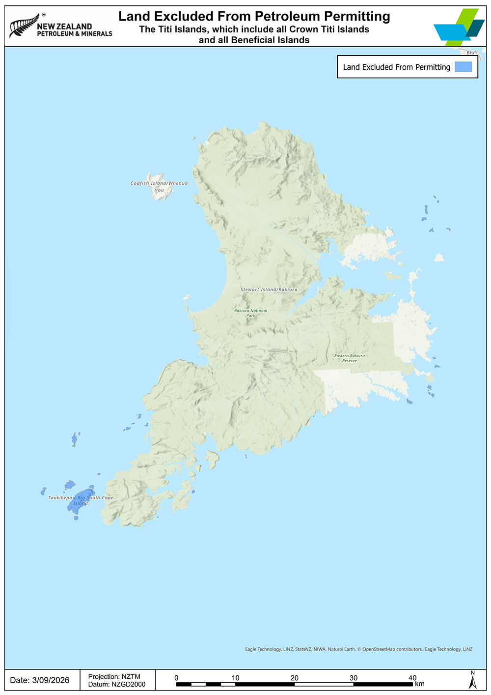
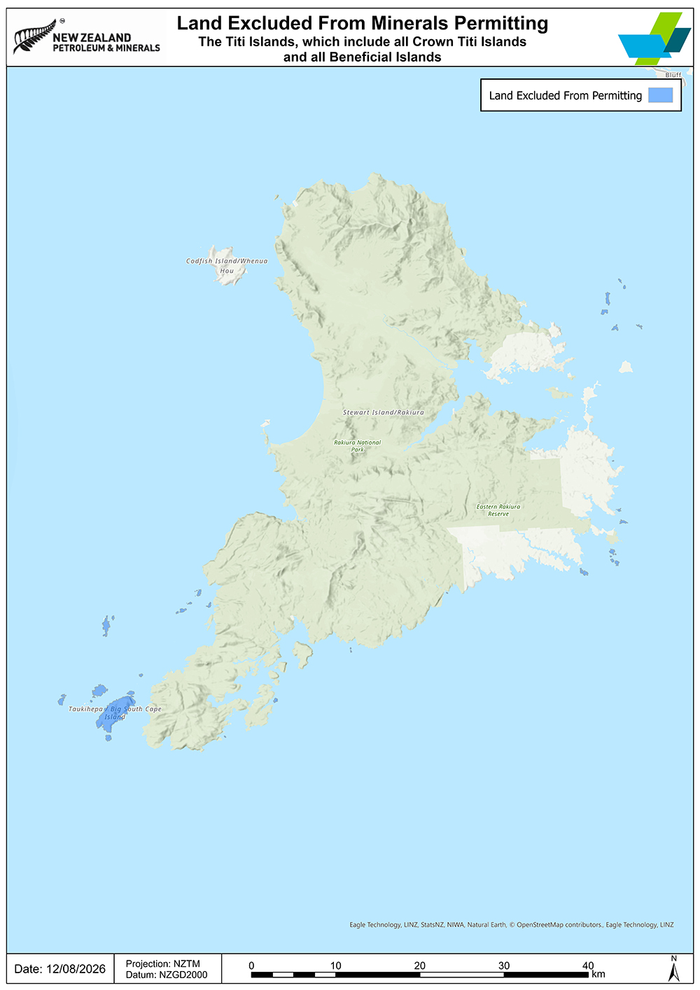
2. The Tītī Islands
Includes all Crown Tītī Islands and all Beneficial Islands.
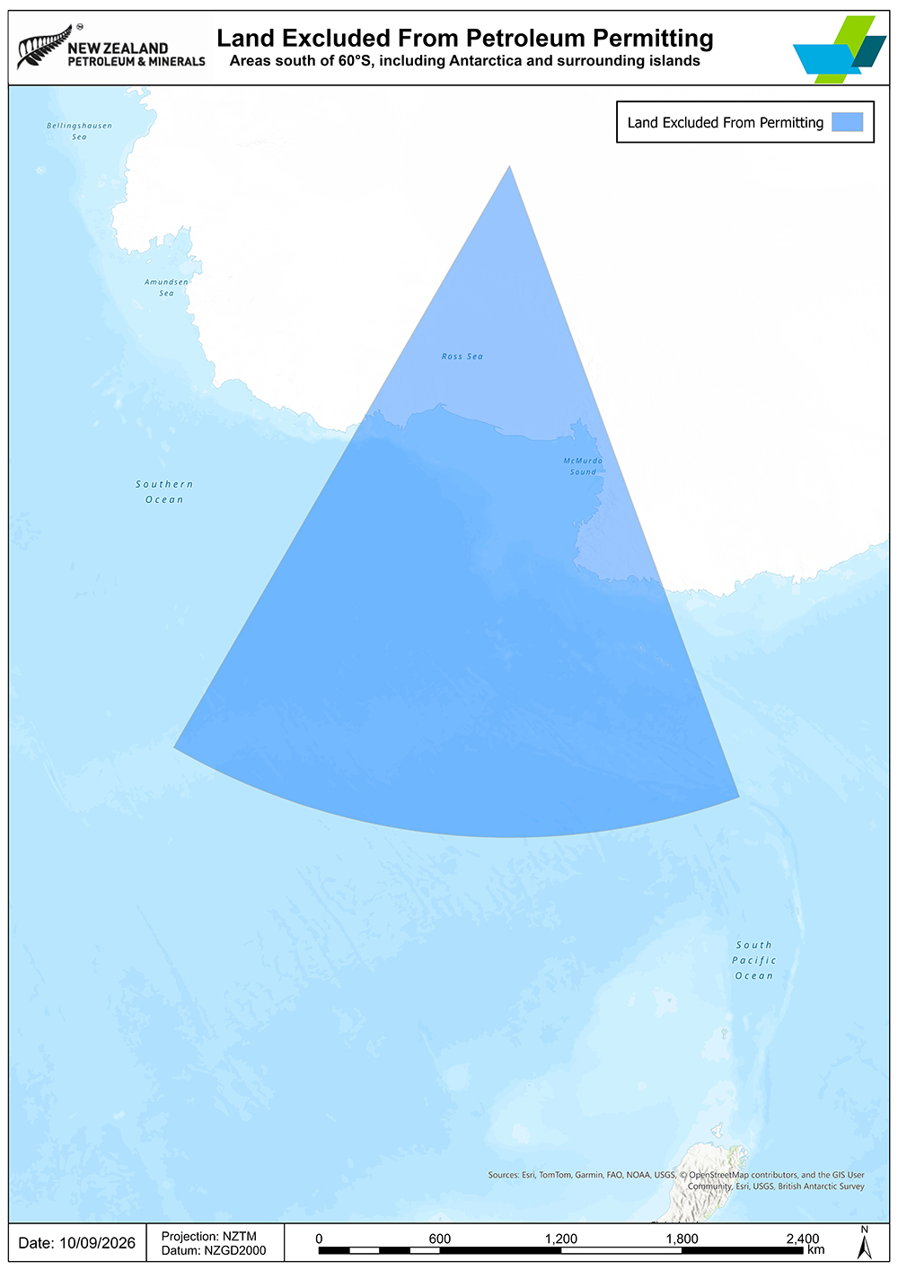
3. Areas south of latitude 60ºS
Includes Antarctica and surrounding islands.
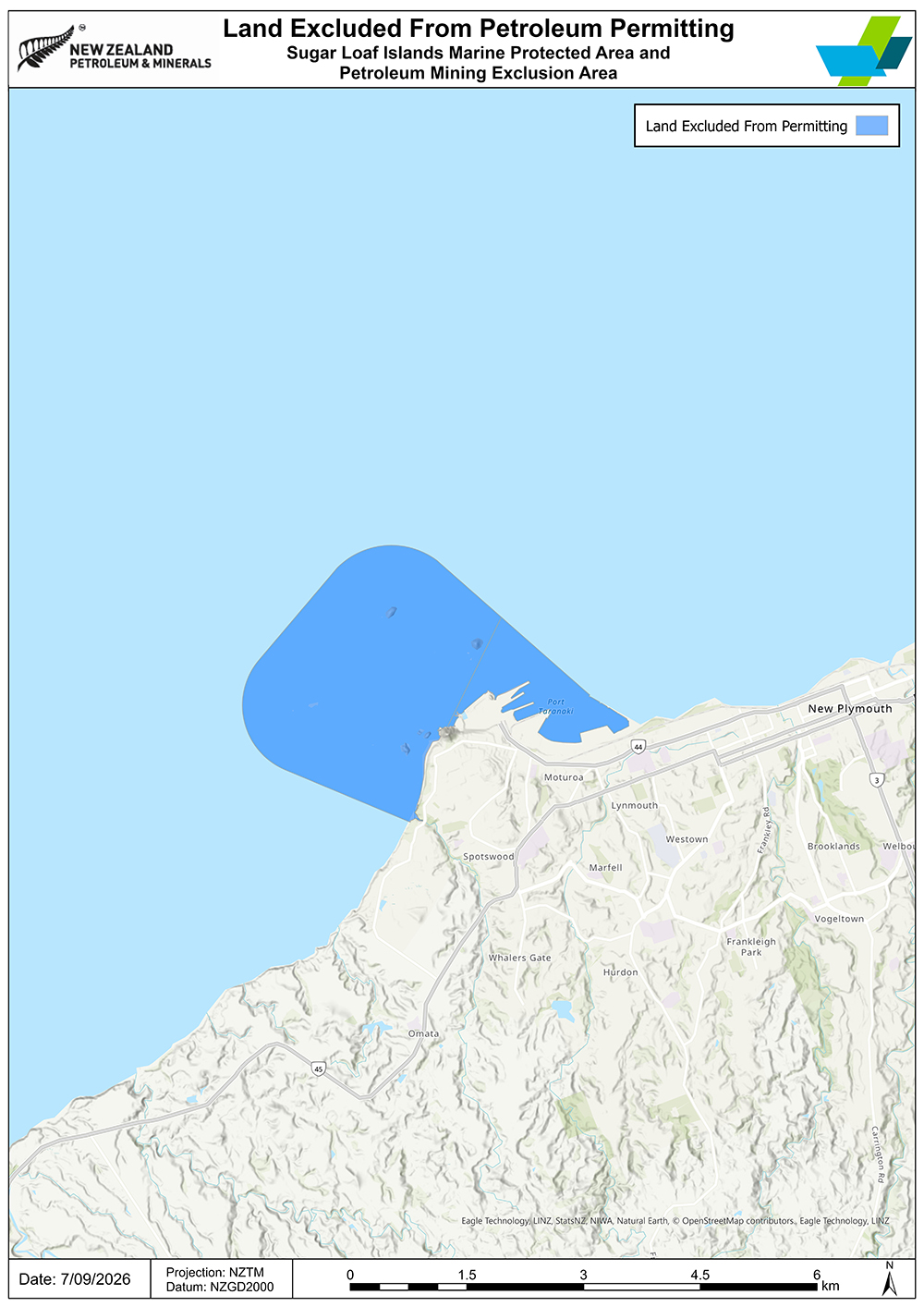
4. The Sugar Loaf Islands Marine Protected Area Act 1991
Full detailed list of Minerals Programme for Petroleum exclusion areas:
Land excluded from the Minerals Programme for Petroleum [PDF 186KB]
Back to Land excluded from the Minerals Programme for Petroleum
Land Excluded from the Minerals Programme (excluding Petroleum)
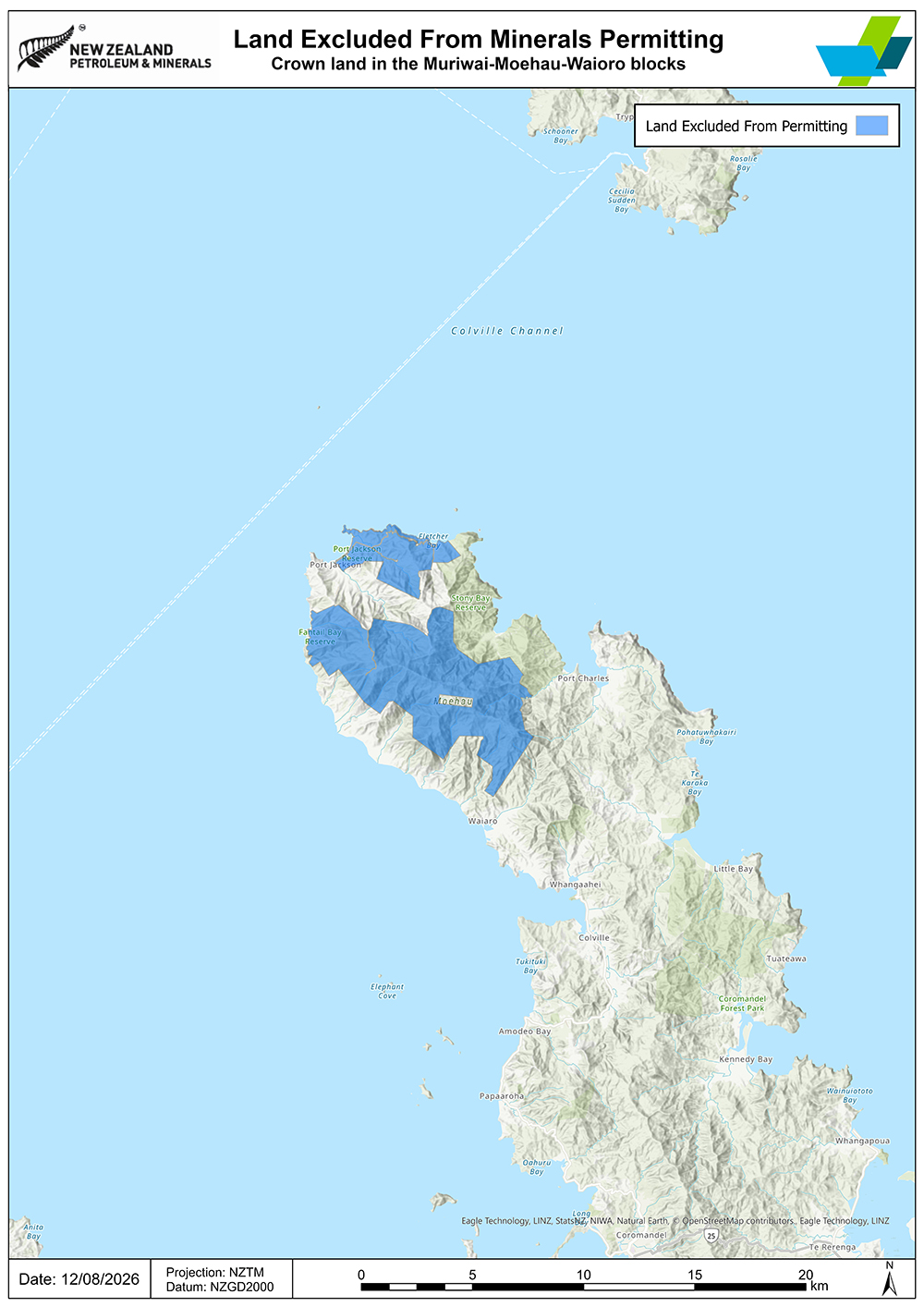
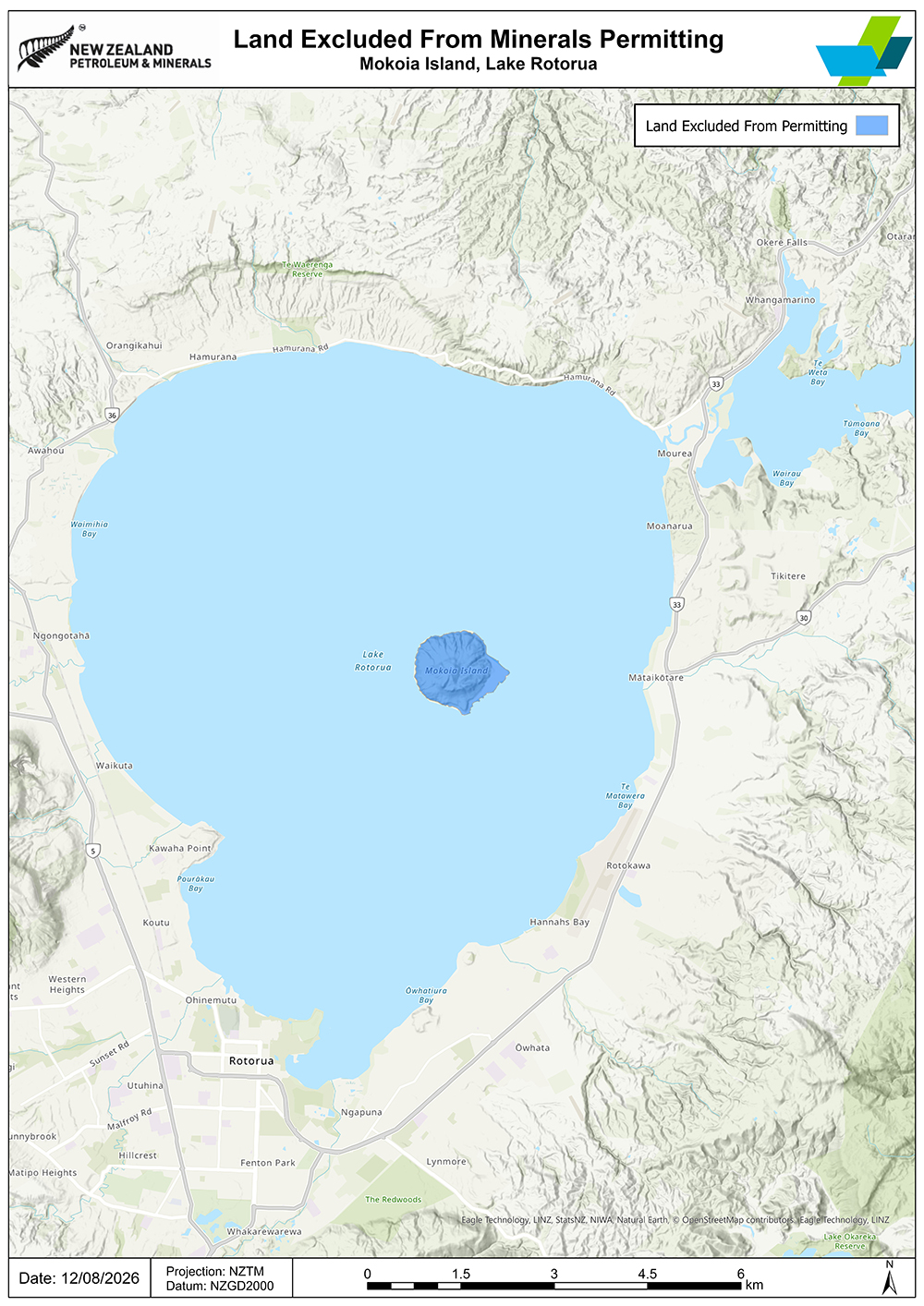
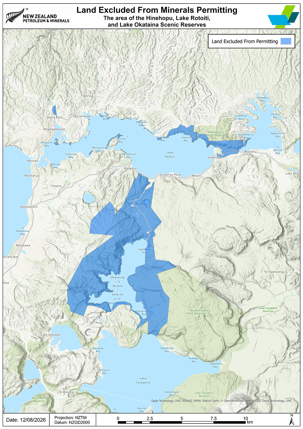
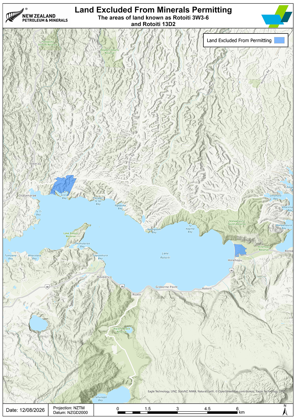
The land listed below is excluded from the operation of the Programme for Minerals (excluding Petroleum) 2025. The excluded land is marked in blue colour.
1. Crown land in the Muriwai-Moehau-Waioro blocks
2. Mokoia Island, Lake Rotorua
3. The area of the Hinehopu, Lake Rotoiti, and Lake Ōkataina Scenic Reserves areas
4. The areas of land known as Rotoiti 3W3-6 and Rotoiti 13D2
5. Te Papa-Kura-o-Taranaki
Includes Te Whenua Taurikura and Te Whenua Taketake, as defined in Schedule 1 of the Taranaki Maunga Collective Redress Act 2025.
6. The Tītī Islands
Includes all Crown Tītī Islands and all Beneficial Islands.
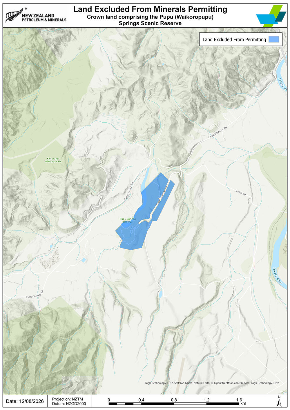
7. Crown land comprising the Pupu (Waikoropupū) Springs Scenic Reserve
Back to Land Excluded from the Minerals Programme (excluding Petroleum)
Full detailed list of Minerals Programme (excluding Petroleum) exclusion areas:
Land excluded from the Minerals Programme (Excluding Petroleum) [PDF 287KB]
Areas proposed for exclusion from New Zealand’s Minerals and Petroleum Programmes due to their importance to iwi or hapū:
Land proposed for exclusion from our minerals and petroleum programmes
Guidance for iwi and hapū on how to request the exclusion of land from the operation of the programmes: